Copyright © 2000,2001
Helmut Gimmler
FAQ Mesh-Development for MS-Flightsimulator 2000
---------------------------------------------------
Status: 2001-Jan-11
meshfaq_e.txt Copyright (c) 2001 Helmut Gimmler
File can be copied, but has to remain unchanged.
Since english is not my native language, any corrections / improvements
to this text would be appreciated.
email: helmut.gimmler@gmx.de
Current version is available from:
http://www.hgimmler.de/
FAQ-Page: Browsing,
Download-Page: Download
* = new compared to (German) version of 2000-Dec-31
** = new compared to version of 2001-Jan-03
A. General:
------------
A.1. What is a 'mesh-file'?
A.2. How can I guarantee that the landscape-pattern is realistic?
A.3. How do I exchange test-sceneries without restarting flightsimulator?
**A.4. What are DEM-data?
B. Creating Mesh-Files:
------------------------
B.1. I want to create a new mesh-area. What are the steps involved?
B.2. Where can basis information and tools be obtained?
B.3. How are parameters for INF-files created?
B.4. Where can I download free elevation data?
B.5. Why should I need a DEM-reader and where can I find one?
**B.6. I do need Satellite-photos. Where should I start my search?
C. Coordinate Systems / Transformation / Grid Distances
--------------------------------------------------------
C.1. Where can I get an introduction about coordinate systems?
**C.2. What are 3.0 Arcsec- / 7.5min- / GTOPO30 ... DEM-data?
C.3. How can I transform Gauss-Krueger-Meterscale into UTM-North-South?
C.4. Are there ready to use transformations online?
*C.5. What is the exact circumference of the earth used in FS2000?
to be continued
A. General:
------------
A.1. What is a 'mesh-file'?
----------------------------
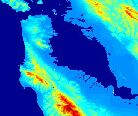
Mesh-sceneries define the elevation model of a landscape in flightsimulator.
With standard textures they represent the 3D-shape of the landscape at nearly
any accuracy. The landscape-pattern (pixel pattern, like wood, field, village,
town) however serve only as an example and are not so realistic.
A.2. How can I guarantee that the landscape-pattern is realistic?
------------------------------------------------------------------
For example, this is achieved by scanning of aerial- or satellite-photos
and transforming them into texture-files. But this is out of the scope of
this web site.
A.3. How do I exchange test-sceneries without restarting flightsimulator?
--------------------------------------------------------------------------
During scenery-tests people often need to test slight changes directly in
flightsimulator without restarting the simulator again and again.
The problem is: Simply overwriting of the old scenery with flightsimulator
running ends up in a crash.
cure:
- inactivate scenery (-> environment -> scenery library),
- delete *all* in your test-scenery-directory;
it is important that 'filelist.dat' is deleted,
this file is recreated while activating the new scenery,
- copy the new scenery-version (*.bgl) in the directory,
- activate the scenery - ready!
A.4. What are DEM-data?
------------------------
A digital elevation model (DEM) is a digital file consisting of terrain
elevations for ground positions at regularly spaced horizontal intervals.
The USGS produces five different digital elevation products. Although all
are identical in the manner the data are structured, each varies in
sampling interval, geographic reference system, areas of coverage,
and accuracy; with the primary differing characteristic being the spacing,
or sampling interval, of the data.
[Source: http://rockyweb.cr.usgs.gov/elevation/dpi_dem.html]
B. Creating Mesh-Files:
------------------------
B.1. I want to create a new mesh-area. What are the steps involved?
--------------------------------------------------------------------
- download elevation data from the internet: USA is available in fine grid,
- use 'read_dem.exe' to separate header-file and elevation-data
- write data from west to east in lines from north to south
as 16-Bit-Integer in a file,
- fill in parameters (for example scale, coordinates) in a *.INF-file,
- convert data with MS-SDK-Tools (see below): resample, compress, tmf2bgl
- insert in FS2K-Scenery
B.2. Where can basis information and tools be obtained?
--------------------------------------------------------
Basic-tools and a first introduction for free via Microsoft:
http://www.microsoft.com/games/fs2000/sdk/fs2000_terrain_sdk.EXE
B.3. How are parameters for INF-files created?
-----------------------------------------------
LOD: LevelOfDetail - grid-spacing
- increment by one means four times data-amount
- LOD=Auto ... never worked for me
here are the most important LODs for small areas (about 50x50km / 35x35NM):
LOD grid spacing[m] (=distance between elevation points)
7 305.8
8 152.9
9 76.4
10 38.2
11 19.1
12 9.6
- you can use elevation data with any distance,
- LOD only defines how they are resampled for flightsimulator,
- the smaller you chose the LOD the bigger edges in your area
are not converted ('resample' seems to do a Fourier-sample
which needs a 'settling-phase' at the edges),
- if 'resample' doesn't create any data or 'tmf2bgl' poduces
an error-message:
-> try to increase the LOD
DestDir: DestinationDirectory for the tmf-file
DestBaseFileName: filename for tmf-file
UseSourceDimensions = 1 ... I used always '=1'
Type = ElevS16LSB Intel(=PC)-format for 16-Bit-Integer-numbers
SourceDir: SourceDirectory for file with elevation data
Sourcefile: file with elevation data in 16-Bit-Integer-format
CellType = S16LSB ... I haven't changed this yet
NullCellValue = -9999 ... number for elevation points, not defined in the
rectangular area, if there aren't data everywhere
Lat: Latitude of the North-West-corner
Lon: Longitude of the North-West-corner (western with negative sign)
NumOfCellsPerLine: Number of elevation points per line (West-East-direction)
NumOfLines: Number of elevation points in North-South-direction
CellXdimensionDeg: Distance of the elevation points in West-East-direction [degrees]
CellYdimensionDeg: Distance of the elevation points in North-South-direction [degrees]
example for 3.0 arcsec-data:
3 arcsec = 3/60 min = 3/(60*60) degrees
CellX...=CellY... = 8.333e-4 = 0.00083333
example for 150m[meters]-data-San-Francisco (37.88 Latitude)
CellXdimensionDeg = 0.001707 (= CellY/cos(37.88degrees))
CellYdimensionDeg = 0.001347 (= 150[m]*360[deg]/40007834[mEarthRadius])
ScaleInMeters: =1.0: elevation in meters; =0.3048: elevation in ft.
B.4. Where can I download free elevation data?
-----------------------------------------------
*The one and only* ;-) homepage for elevation data download:
U.S. Geological Survey
a) only USA
'FTP via Graphics' allows download with a click on the desired area
- USA in 30m-spacing (100 ft.) with some gaps:
1:24,000 Scale Digital Elevation Models (DEM) SDTS format only
- USA in 93m-spacing (300 ft.), almost full coverage:
1:250,000 Scale Digital Elevation Models (DEM)
http://edcwww.cr.usgs.gov/doc/edchome/ndcdb/ndcdb.html
b) global
- complete earth in 900m-spacing (3000 ft.)
GTOPO30 - Global Topographic Data
http://edcdaac.usgs.gov/gtopo30/gtopo30.html
B.5. Why should I need a DEM-reader and where can I find one?
--------------------------------------------------------------
The program 'DEM-reader' reads in digital elevation model (DEM)-files
both USGS-ASCII-format and SDTS-format (Spatial Data Transfer Standard),
creates 16-Bit elevation data as well as an ASCII-headerfile with
an exact description of the elevation data (grid spacing,
coordinates of the area etc.)
The PC-executable 'read_dem.exe' (and the C-Code) is available:
Pennsylvania State University, Earth System Science Center
http://dbwww.essc.psu.edu/notes/utilities.html
B.6. I do need Satellite-photos. Where should I start my search?
-----------------------------------------------------------------
Although this is out of the scope of this web site: ;-)
Earth from Space - Technical Search:
http://earth.jsc.nasa.gov/page.html
Search All Astronaut Photography of Earth - Clickable Map:
http://eol.jsc.nasa.gov/sseop/clickmap/
C. Coordinate Systems / Transformation / Grid Distances
--------------------------------------------------------
C.1. Where can I get an introduction about coordinate systems?
---------------------------------------------------------------
Coordinate Systems by Peter H. Dana
http://www.Colorado.EDU/geography/gcraft/notes/coordsys/coordsys_f.html
C.2. What are 3.0 Arcsec- / 7.5min- / GTOPO30 ... DEM-data?
---------------------------------------------------------
3.0 Arcsec = 3*40000000[mEarthRadius] / (360[deg]*60[min]*60[sec])
= 92,6m-grid-data North-South and at the equator also West-East
Description Grid-Distance Area per File
------------------------------------------------------------------------
GTOPO30 /30 Arcsec/1km 30 arcsec=900m (Equator) 40x50 Grd (WOxNS)
1-Deg-DEM/3 Arcsec /1:250,000 3 arcsec = 90m (Equator) 1 x 1 Grd 1201x1201Pts
/2-Arcsec 2 arcsec
SDTS /7.5min /1:24,000 30m überall 7,5 x 7,5 Min
/7.5minAlaska/1:24,000 1x2arcsec
/15min Alaska 2x3 arcsec
C.3. How can I transform Gauss-Krueger-Meterscale into UTM-North-South?
------------------------------------------------------------------------
Instructions for coordinate transform with algorithms and parameters:
42 pages / 750KB PDF-file:
A guide to coordinate systems in Great Britain
http://www.ordsvy.gov.uk/services/gps-co/geo6.htm
Ordnance Survey, the national mapping agency of Great Britain
C.4. Are there ready to use transformations online?
----------------------------------------------------
Here you find a ready to use input-form for all people
who don't want to 'fight' with formulas:
http://home.t-online.de/home/Bernd.Scherer/koord.htm
C.5. What is the exact circumference of the earth used in FS2000?
------------------------------------------------------------------
from MS-scenery-SDK.pdf:
in FS2000, the earth is an ellipsoid:
similar (not equal to) WGS-84-definition
Equatorial diameter: 12756.27 km
Equatorial circumference: 40075.0 km
Polar diameter: 12734.62 km
Polar circumference: 40007.0 km
to be continued